4/8/26 – PUBLIC URGED TO MONITOR REAL-TIME STREAM CONDITIONS AS STORM APPROACHES HAWAIʻI
|
JOSH GREEN, M.D. GOVERNOR |
RYAN KANAKAʻOLE |
PUBLIC URGED TO MONITOR REAL-TIME STREAM CONDITIONS AS STORM APPROACHES HAWAIʻI
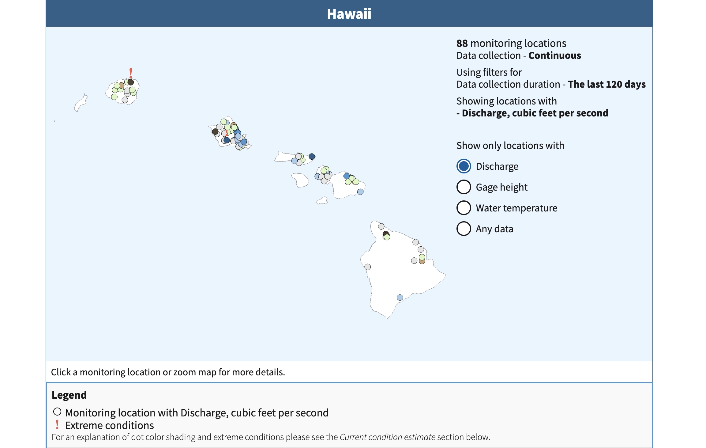
USGS Water Data for the Nation – Hawaiʻi web page.
HONOLULU – With a third storm system forecast to impact the state of Hawaiʻi over the next few days, residents and visitors are reminded that real-time stream data is available as one of several tools they can use to stay informed.
The United States Geological Survey (USGS), in partnership with the State of Hawaiʻi Commission on Water Resource Management (CWRM) and other state and county agencies, provides publicly accessible, near-real-time data on stream level discharge at 88 monitoring locations across the five main Hawaiian Islands through its Water Data for the Nation website:
https://waterdata.usgs.gov/state/hawaii/
To check current conditions:
- Select “Discharge” under the “Show only locations with” on the right of the screen.
- Zoom in to the island and click the gauge location you wish to check.
- Note any locations with a red exclamation point which alerts users to “! Extreme conditions.”
- A color code legend and other information appears below providing users with information.
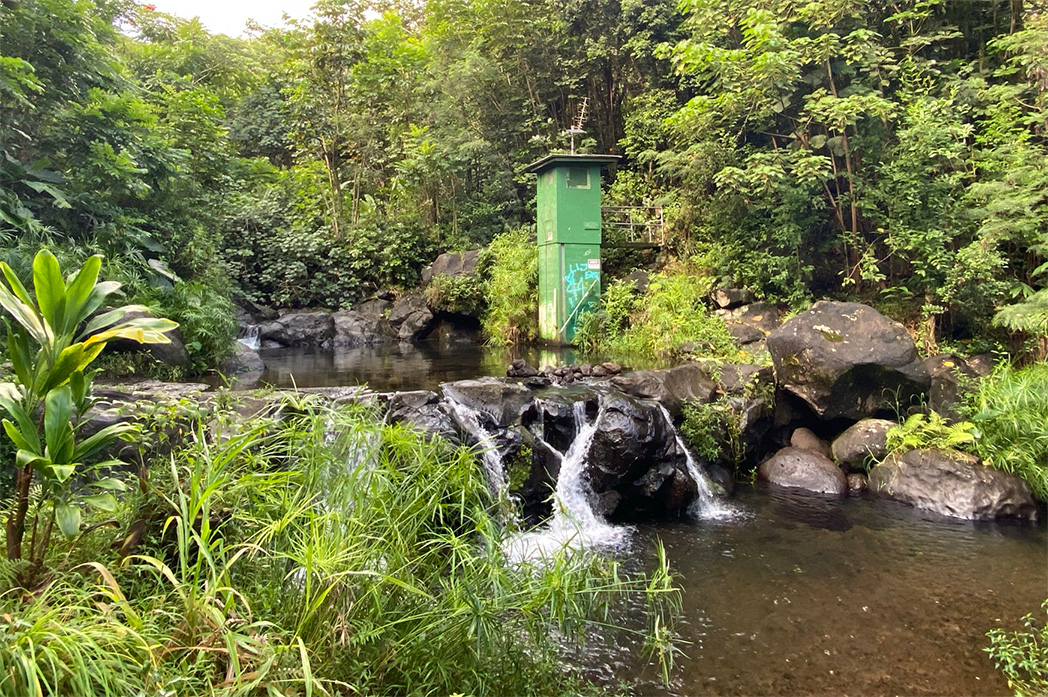
A stream gauge in Heʻeia Stream, Haiku Valley near Kāneʻohe, Oʻahu.
Stream gauges throughout the islands are typically updated every 15 minutes, offering timely information on rapidly changing conditions during heavy rainfall events.
CWRM advises that real-time stream data is a valuable situational awareness tool, but it should not be used as the sole basis for safety decisions.
Because conditions can change rapidly between updates, the public should rely on official warnings and alerts from the National Weather Service, Hawaiʻi Emergency Management Agency, and county emergency management agencies, as well as using their own judgment when conditions appear unsafe.
For those who wish to receive notifications, the USGS also offers WaterAlert, a free service that sends text or e-mail updates when water levels at selected gauges reach user-defined thresholds:
https://accounts.waterdata.usgs.gov/wateralert/
Residents and visitors can find information on preparations and safety precautions for heavy rain, flooding, strong winds, power outages, large surf and coastal surge on the Hawaiʻi Emergency Management Agency (https://dod.hawaii.gov/hiema/) and county emergency management agencies’ websites.
More weather information is available at: https://www.weather.gov/hfo
# # #
RESOURCES
(All images/video courtesy: DLNR)
Photos – USGS and CWRM Stream Gauges throughout the Islands:
Media Contact:
Andrew Laurence
Communications Director
State of Hawaiʻi Department of Land and Natural Resources
Phone: 808-587-0396
E-mail: [email protected]
Legal Disclaimer:
EIN Presswire provides this news content "as is" without warranty of any kind. We do not accept any responsibility or liability for the accuracy, content, images, videos, licenses, completeness, legality, or reliability of the information contained in this article. If you have any complaints or copyright issues related to this article, kindly contact the author above.
